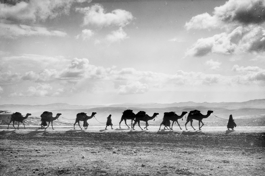
Egyptian camel transport passing over Olivet, 1918 | Library of Congress | Public Domain
It is commonly accepted these days that data is one of the most valuable raw materials that exist, for better and for worse. Data can guide democratisation or generate inequalities. Everything depends on who produces it, manipulates it or manages it. Open mapping communities are spreading, developing and growing stronger in Africa as a way of producing such data, from and for society’s base; of filling a gap that is related with them taking charge of their own destinies; and of improving, from within, the conditions for development. The philosophy of collaborative mapping also connects with the community spirit and sentiment of common good entrenched in many African traditions.
When, in March 2014, the first Doctors Without Borders teams reached the region of Guéckédou, in the Republic of Guinea, to respond to the last major outbreak of Ebola in western Africa, they came up against a fundamental problem: they were blindfolded. There were no detailed maps of the area that allowed them to plan their actions. They had to resort to an emergency collective mapping effort with help from different organisations working on collaborative mapping. At that moment in time, Open Street Map (OSM) communities were a rarity in western Africa. Today, these groups are now dotted all over the sub-region and form a network with considerable potential to accompany development projects of all types.
Today the OSM communities have not only mapped most of the towns in great detail, but also extensive rural areas that have no interest for the commercial map systems that any user can access online. In other words, the same town of Guéckédou, a Guinean locality with barely 70,000 inhabitants (in 2014) at the frontier with Liberia and Sierra Leone, has each of its buildings detailed on Open Street Map, whereas for Google Maps, for example, it is barely a silhouette. The members of the communities have defined thousands of kilometres of the road network on the maps and have given cartographical support to the fight against natural and human processes that endanger human lives.
Today, in the Senegalese city of Saint-Louis, Lamine Ndiaye leads the geographical documentation effort relating to the impact of sudden rises in sea levels that are occurring regularly and causing significant damage to one of the most iconic cities of Western Africa. On the Ivory Coast the country’s roads have been recorded with detail and also now on the map are its health and care resources for tackling HIV. Meanwhile in Guinea, the routes of the bus lines of the capital, Conakry, have been mapped out.
These are just some examples of initiatives through which collaborative mapping communities are trying to provide a solution for everyday problems that have not received attention from government or businesses, sometimes due to a lack of resources or capacity and others due to a lack of interest. But the action of these communities goes far beyond their commitment to the closest environment, which is evident, enabling their self-mobilisation for solidarity actions to offer a response to more global challenges. Malian activist Nathalie Sidibé is an authority on open mapping across the entire region and she recalls how numerous communities have become involved in campaigns for mapping areas affected by Ebola in the Democratic Republic of the Congo, or for the humanitarian response to the effects of Hurricane Matthew in Haiti.
One of the main motivations for becoming involved in OSM communities in the African continent is related with the objective of producing open data that can be reused, shared and reproduced in any project that is aiming towards social improvement. Emmanuel Adjogble is one of the prominent members of the Togolese OSM community and he highlights some of the fundamental challenges. “Map data is fundamental these days but, where can you find this data when you need it? You find yourself forced to resort to official cartography services. You need to have money because they are going to bill you for it, but also they are going to offer you data that is not up-to-date. In countries like my own, official data can date back to 1970 or 1980 and we are now in 2018”, Adjogble ironizes. Taking into account these conditions, the reflection is simple: “Why not produce data on our countries that is accessible for everyone, through a free and gratis system such as the OSM?” asks this Togolese activist.
Burkinese citizen Guiella Gildas is a committed defender of everything that sounds like open source and collaborative work. He was one of the driving forces behind the local OSM community nearly five years ago. His starting point abounds along the same lines: “For me, open mapping is interesting in Africa because it enables us to master our own territory a little better. And that means being able to digitalise our areas of interest, facilitating our mobility and our interactions; interventions in cases of emergency, but also allowing us to have a fundamental knowledge of our local environment”.
Nathalie Sidibé refers directly to the results of the voluntary and community work that the different groups have carried out. For this open-mapping expert, it is sufficient to see how the contributions of local communities are helping “to improve mobility in African towns, to prevent floods, to facilitate access to health or to drinking water, through the accompaniment of mobile apps, for example”. She continues: “We are constantly thinking about how our communities can contribute solutions through those open data that we can produce, towards achieving Sustainable Development Goals.”
Perceived as a tool for development for African countries, some members have reached OSM communities through a civic and citizenship commitment, as defended by Sally Bilaly Sow, a young lynchpin of the open mapping group of the Republic of Guinea. “It is not possible to talk about development without having control over the territory, without mastering it. The OSM communities in Africa can be one of the driving forces of development”, assures Sow, because from his perspective it is data that enables projections and planning to be made, with snapshots taken of current situations in order to identify challenges and propose strategies for overcoming difficulties.
Thus, OSM communities are major producers of free and gratis open data that become tools for researchers and entrepreneurs alike. “The fact that they are open data does not mean that they cannot be used to develop business enterprises,” comments the young Guinean, referring for example to a mobile app that makes use of the mapping of the bus routes of Conakry.
The position of Ivorian Aurelien Kouame is very similar. His experience in open mapping leads him to assure that without a base map of the territories, local development is practically impossible. For him, the production and exchange of geographical data that communities generate are a direct way of improving the everyday life of citizens, due to the use that can be made of such data. Senegalese citizen Lamine Niaye goes into a little more depth:
Today, OSM communities have a very important role to play in the liberation of the geographical data of developing countries, becoming a fundamental tool in aiding the decision-making of political powers and international institutions. Furthermore, the reuse of data is added to generate applications that contribute sustainably to the endogenous development of our countries and of the continent in general. Cartography is a cross-cutting discipline that intervenes in many aspects that have an influence on the improvement of people’s living conditions.
Sally Bilaly Sow, who recognises that he belongs to one of the latest OSM local communities to arrive on the scene in the African continent, mentions the value of the community aspect: “Sometimes, when we are doing promotions of open mapping, we meet young people who ask us what they will get in return, and I talk to them about the community experience of collaborative work, which enables bonds to be established with people with different profiles. Those relationships might be useful to you in the long term, that is what I tell them”. His own community, that of Guinea, has been built largely like the others, through contact with activists with more experience. It is common for there to be sharing, between the different communities, whether in the form of self-learning sessions or support and collaboration being offered to each other and, often, participation in the same projects when international calls go out.
In his reflections, Guiella Gildas repeats two ideas over and again: community spirit and the common good. Gildas finds in these two concepts the pillars of collaborative mapping, but also, from his perspective, these are two of the most frequently-found values in traditional African cultures. This Burkinese national warns:
With a system like OSM we maintain a sense of community spirit, which for us is very important. But also, the fact that there are numerous producers of these data means that they are more reliable. In the situation that our countries find themselves in, where infrastructures are changing very quickly, for example, we need a system that updates itself quickly. And OSM allows us that, while Google Maps, for example, does not follow this rapid evolution of the continent.
In reference to the different work formulas that persist in many corners of the continent, Gildas points out that “the notion of collaboration and the collective sharing of efforts is what is enabling us to overcome the development gap that has become a buzzword in recent times”.


Nils | 11 January 2019
Great article! Had a chance to support the mapping community in Guinea and it’s beautiful to see how maps are often a great entry point to more complex topics, like how to visualize data and sometimes young motivated mappers evolve to become experts and even software developers.
Leave a comment